The Truro Historical Society has reproductions of vintage maps for sale. Please contact [email protected] for more information or to place an order.
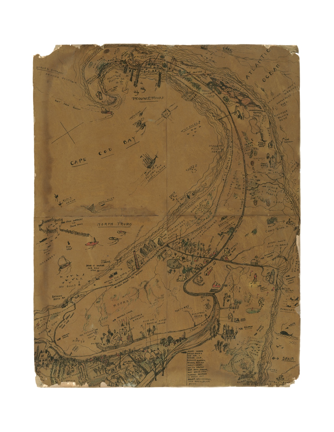
1. Jerry Farnsworth Hand Drawn Map of Truro & Provincetown – 1920s
18.75″ x 14.5″= $80
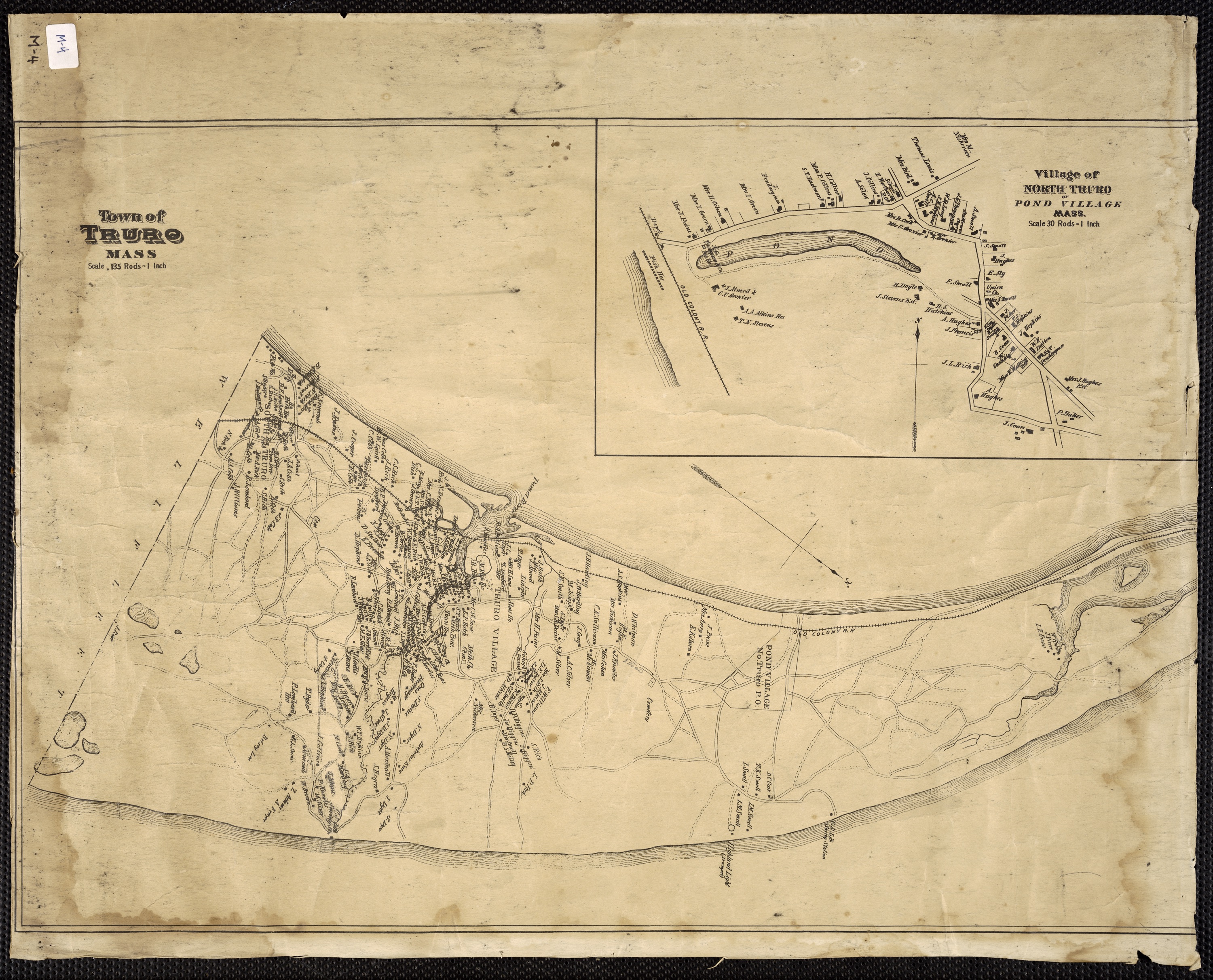
2. Village of North Truro – Pond Village – 1880
14″x 10″ = $30
x18″ x 12 = $45
29.5″ x 19″ = $60
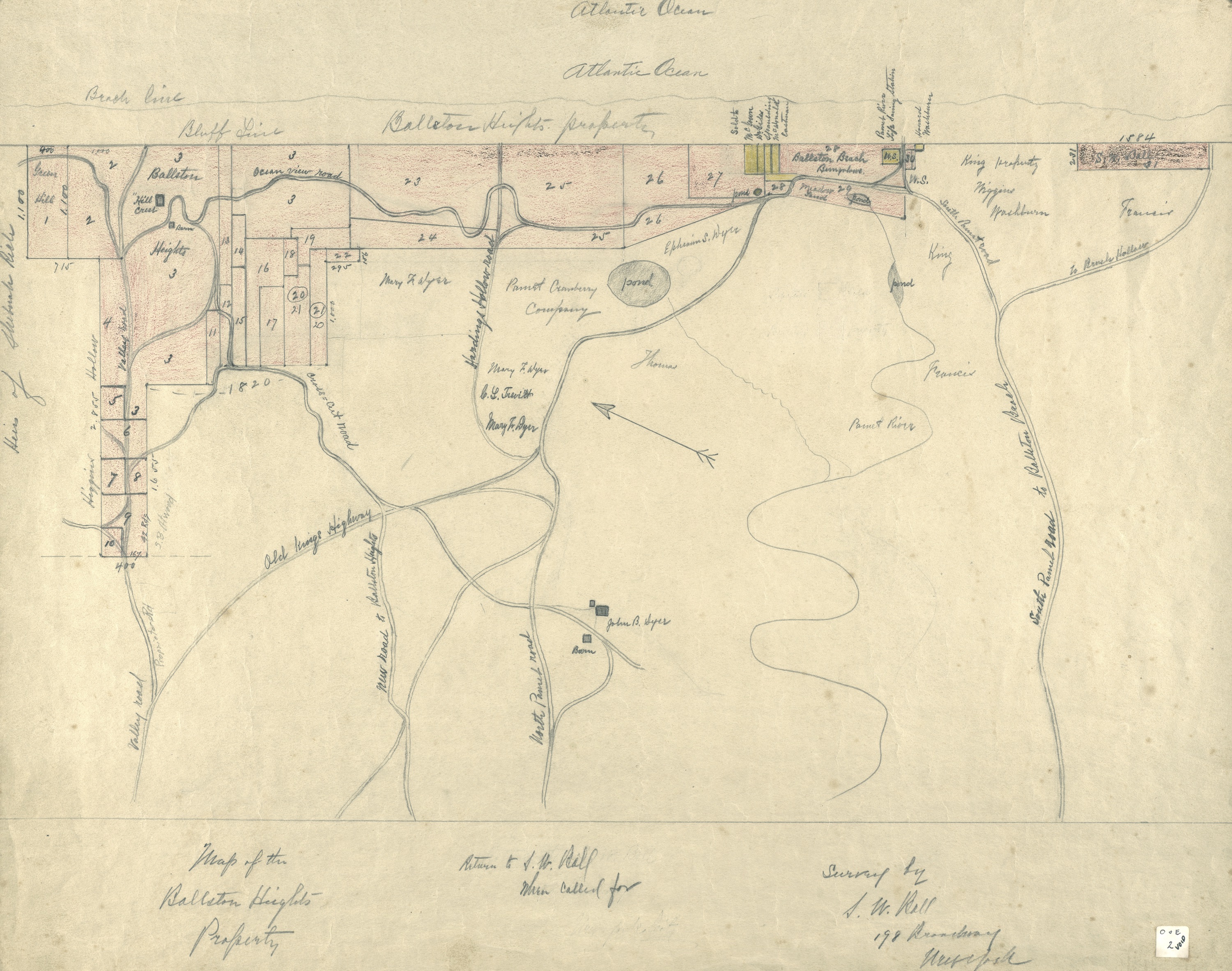 3. Ballston Beach Hand Drawn by S. W. Ball – 1880s
11″x14″ = $40
3a. Provincetown Harbor 1910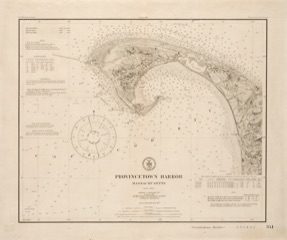
17″x 20 1/2″ = $60
28.5″x20.5″ = $60
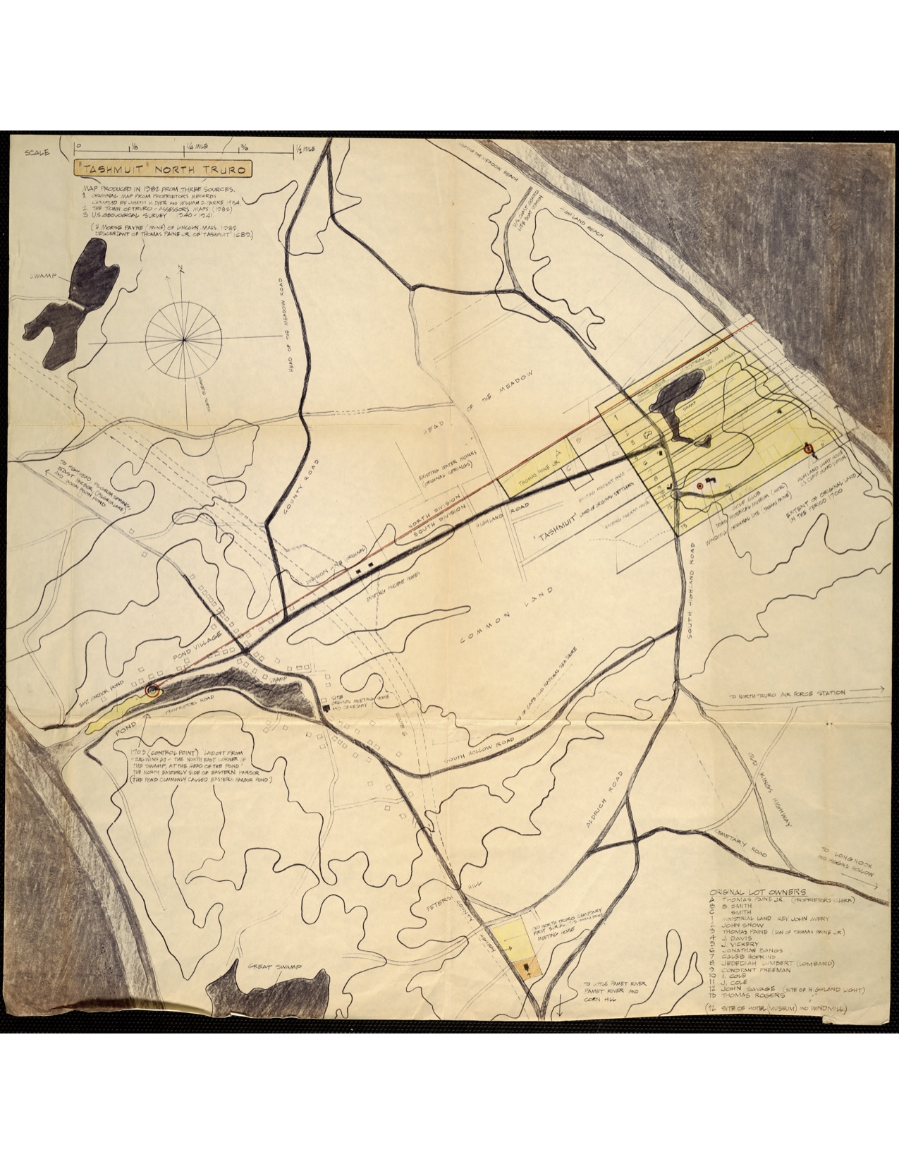
5. Tashmuit – N.Truro
25.5″x25.5″ = $65
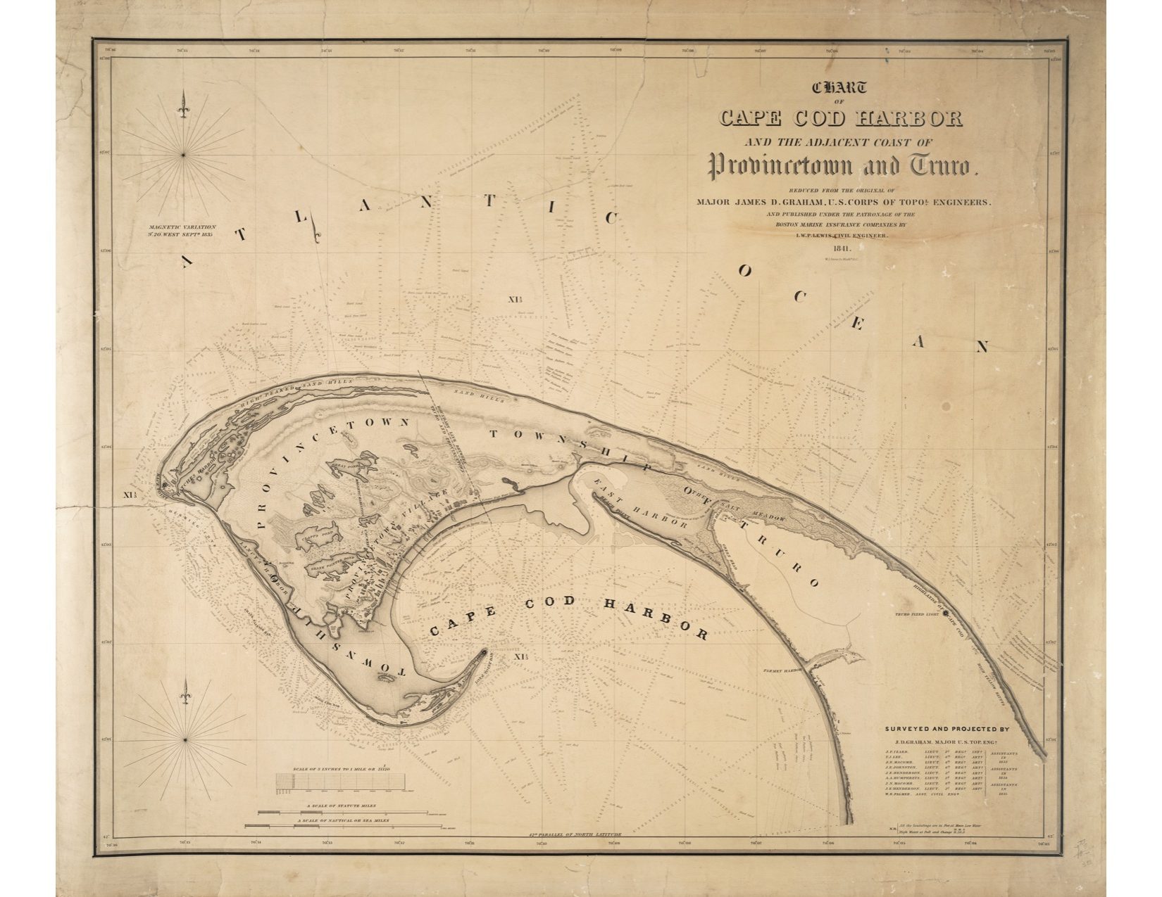 6. Cape Cod Harbor 1841
28.5″x33.5″ = $70
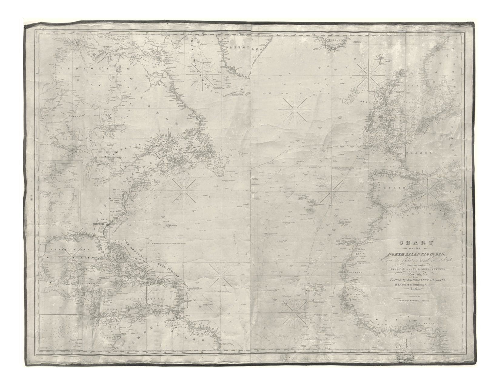
7. 1844 North Atlantic Bluebook
15.25″x20″ = $25
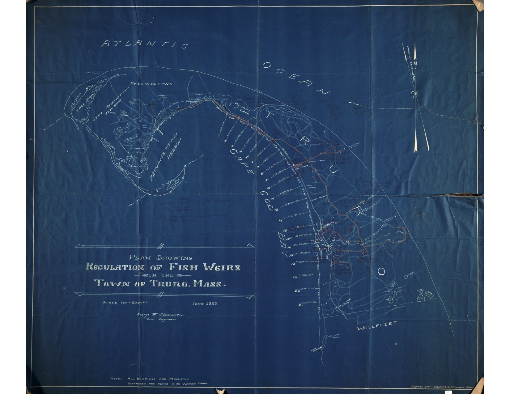 8. 1923 Regulation of Fish Weirs in the Town of Truro
11″x13″ = $40
32″x37.5″ = $ 125
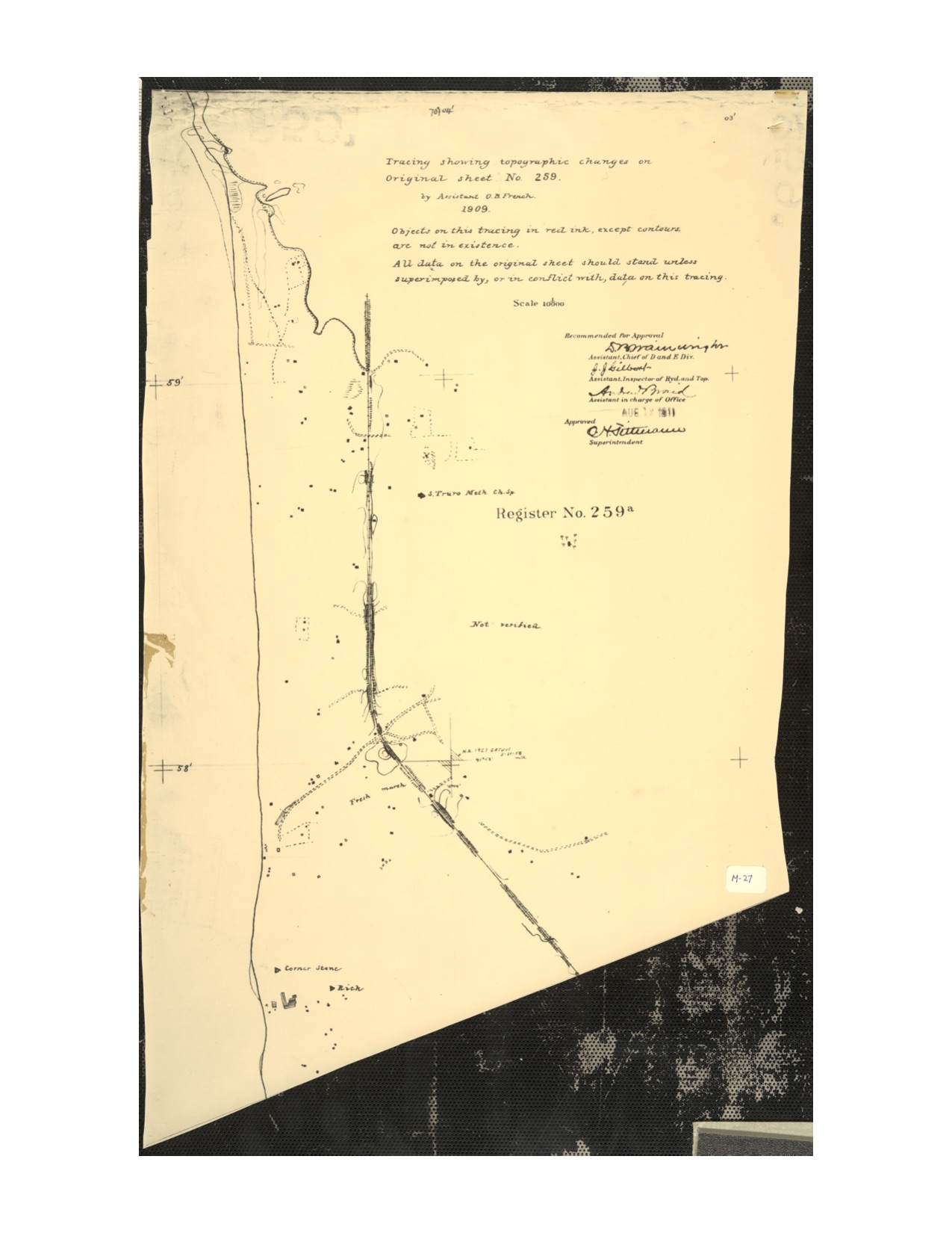
9. 1909 Topographic Map of S. Truro by O. B. French
19.5″x11.5″ = $60
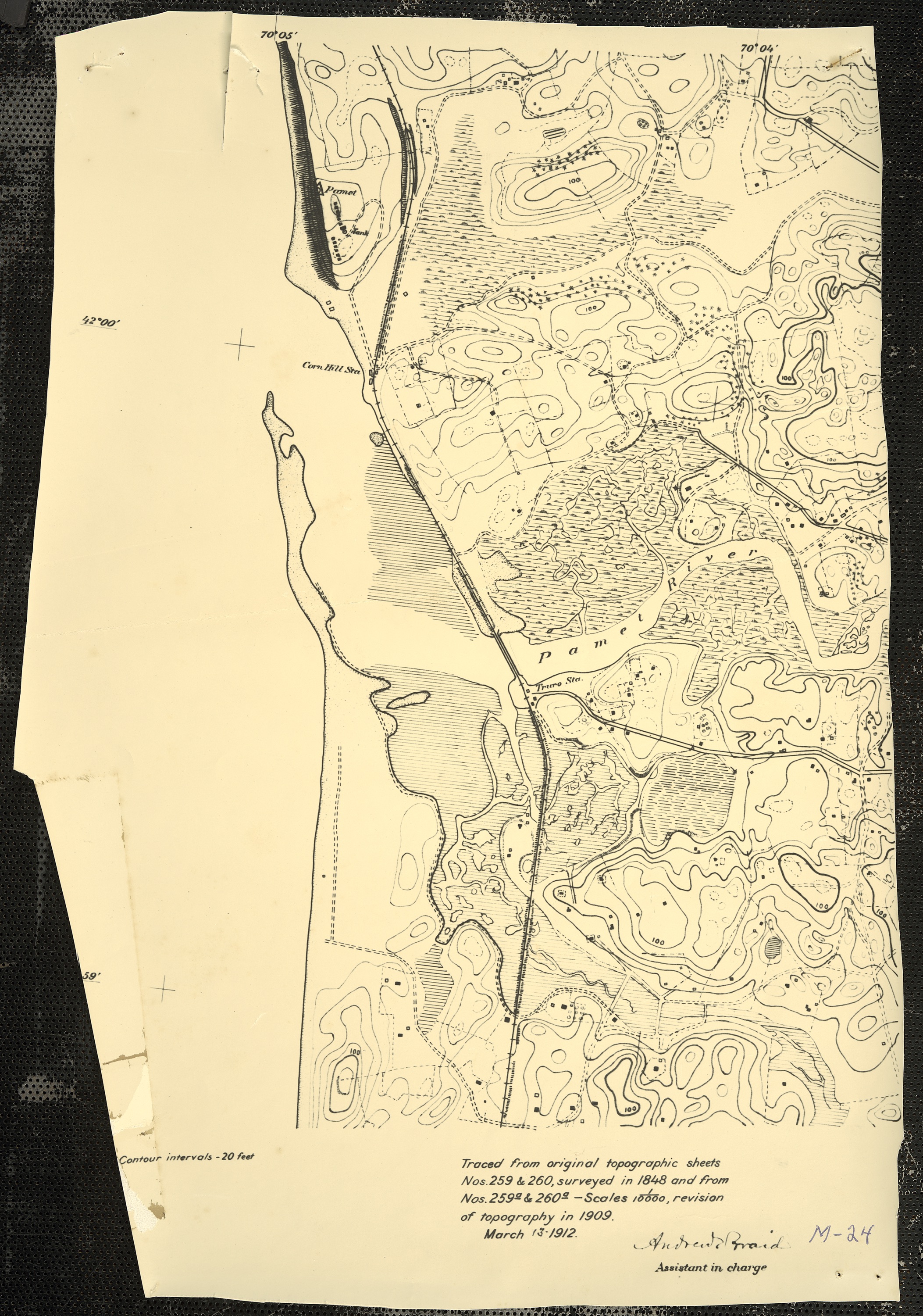
10. Pamet River Topographical Map 1912
14.33″x9.62″ = $30
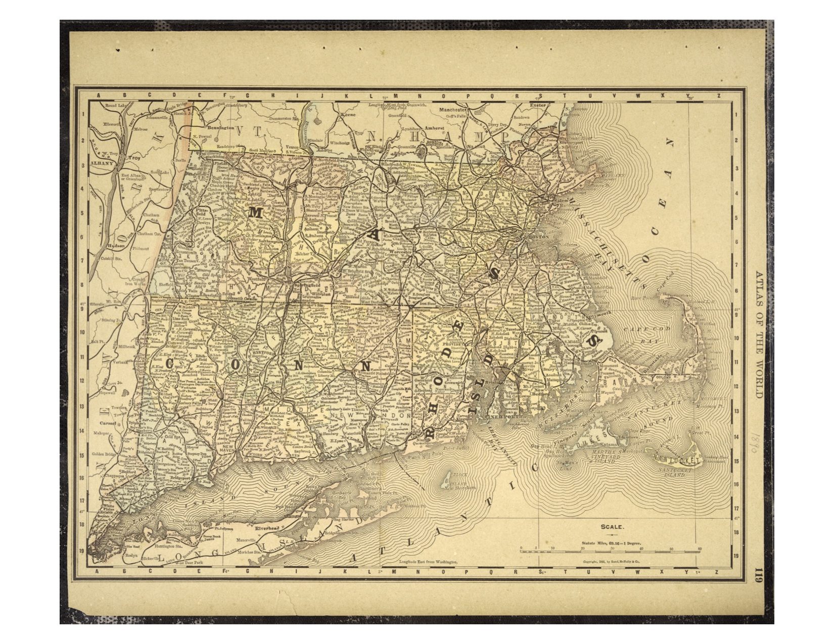 11. Atlas of the World – 1890 New England
15.5″x18.5″ = $60
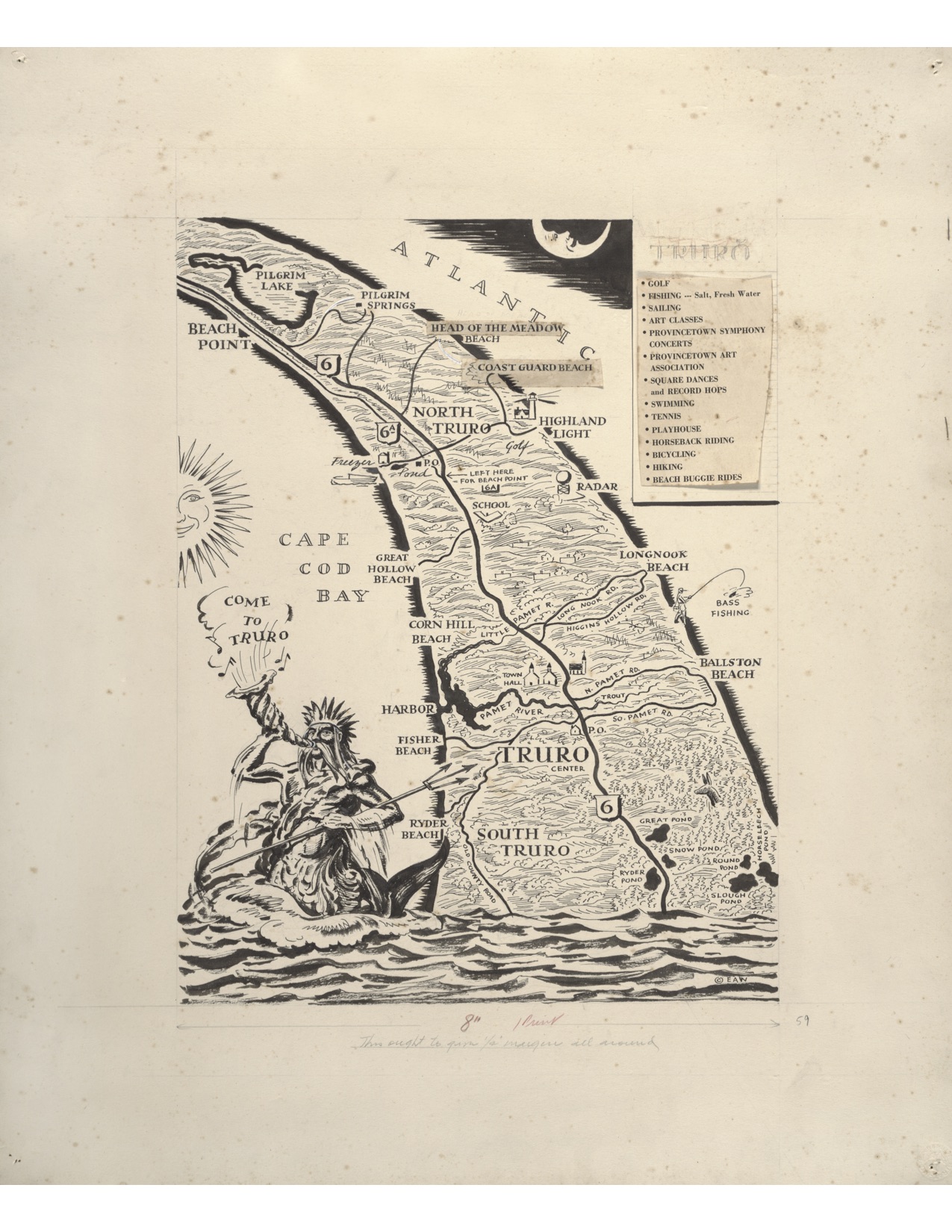
12. “Neptune” Decorative Map by Edward Wilson – 1960
20″ x16″ = $60
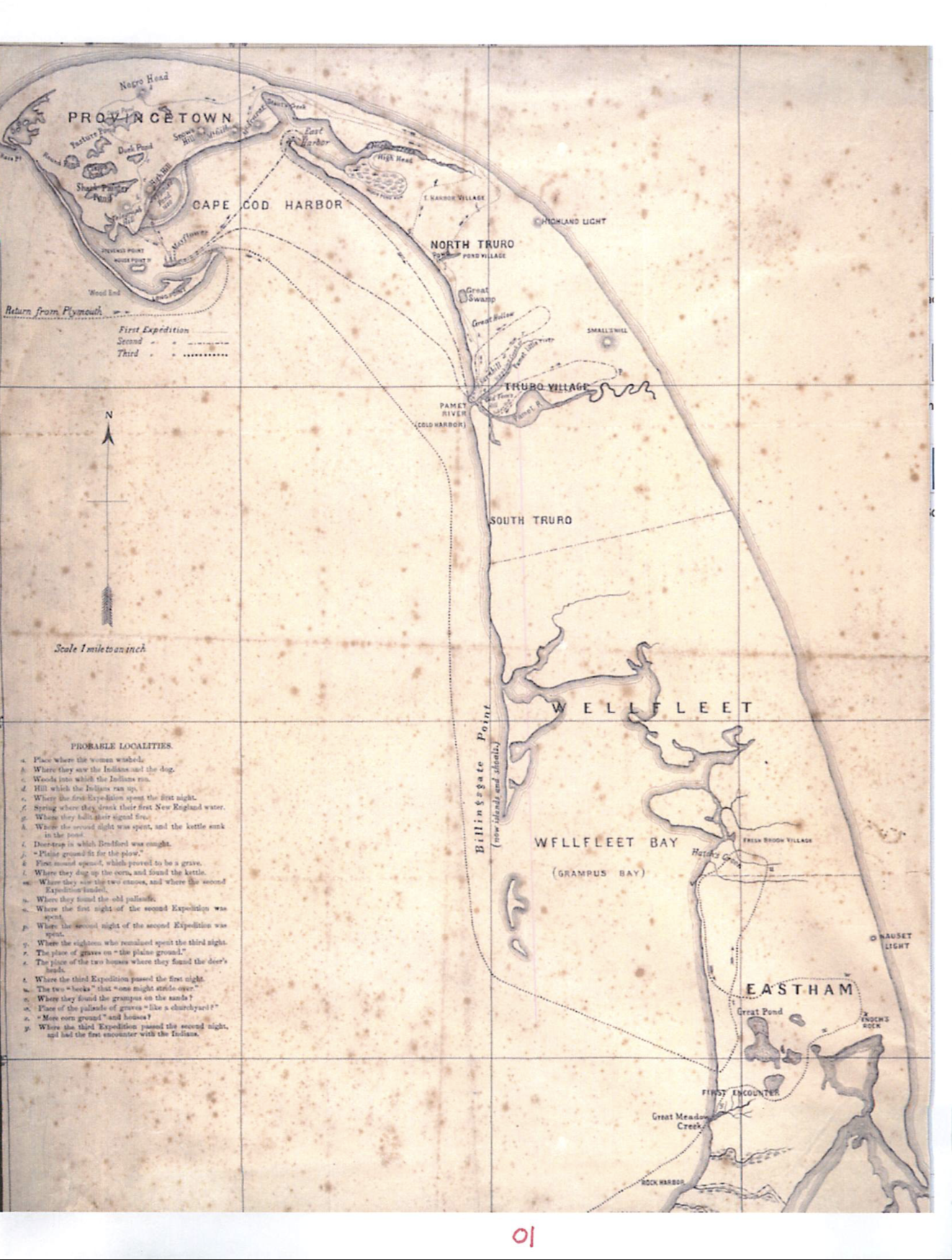
13. 1865 ‘Mourts Relation’ Map of 1620 Pilgrim Exploration
20″x16.75″ = $60
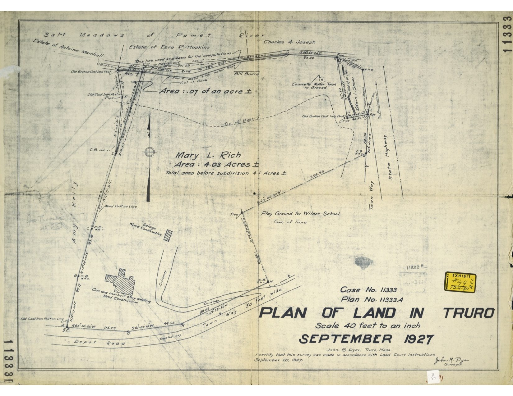
14. Plan of Land Truro Mary Rich John Dyer 1927
19″ x25.5″ = $35
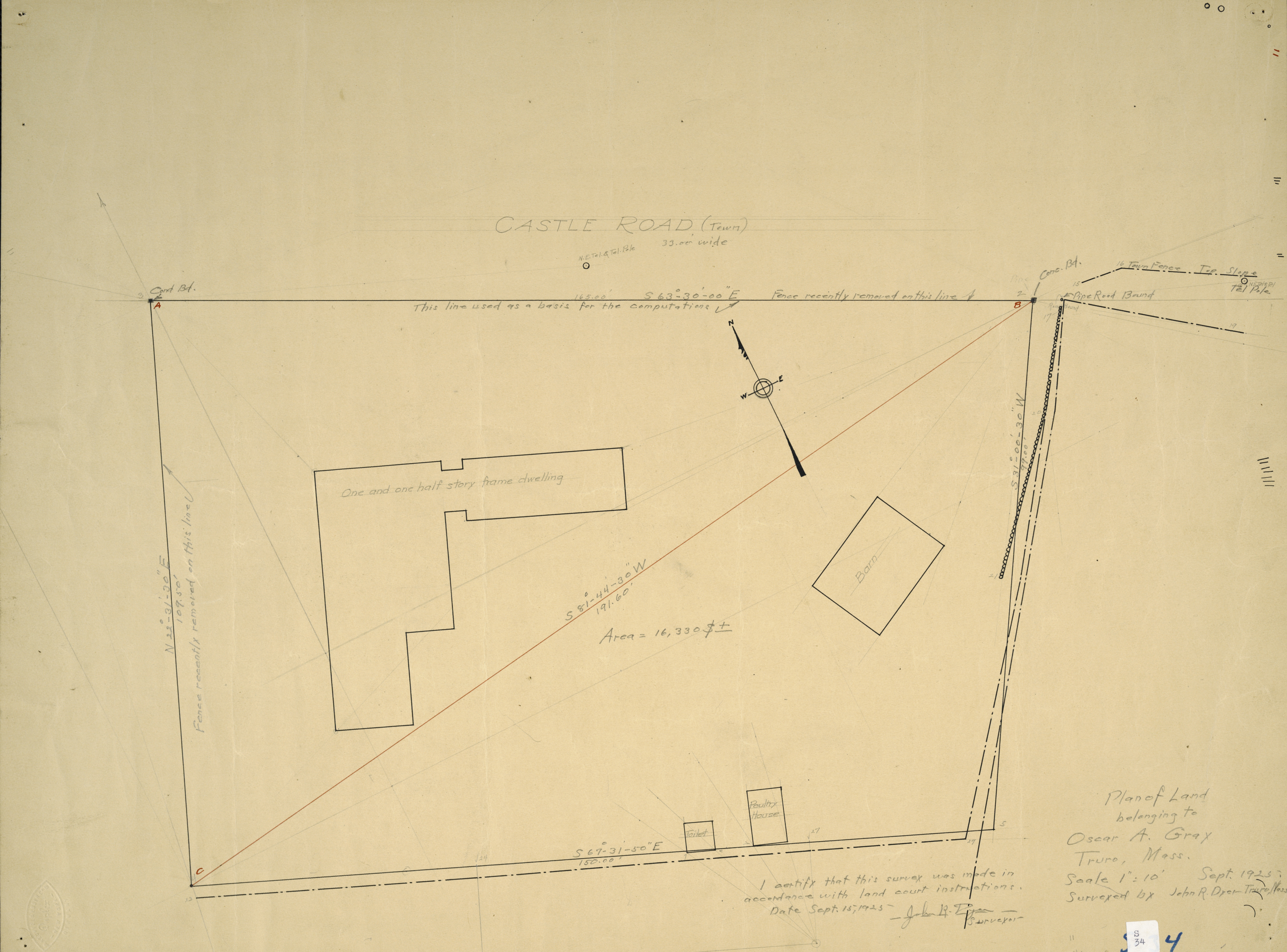 15. Plan of Land Oscar Gray by John Dyer 1925
19×25 = $35
16. Map of Pamet Drainage by Chet Lay 1909 – no image available yet
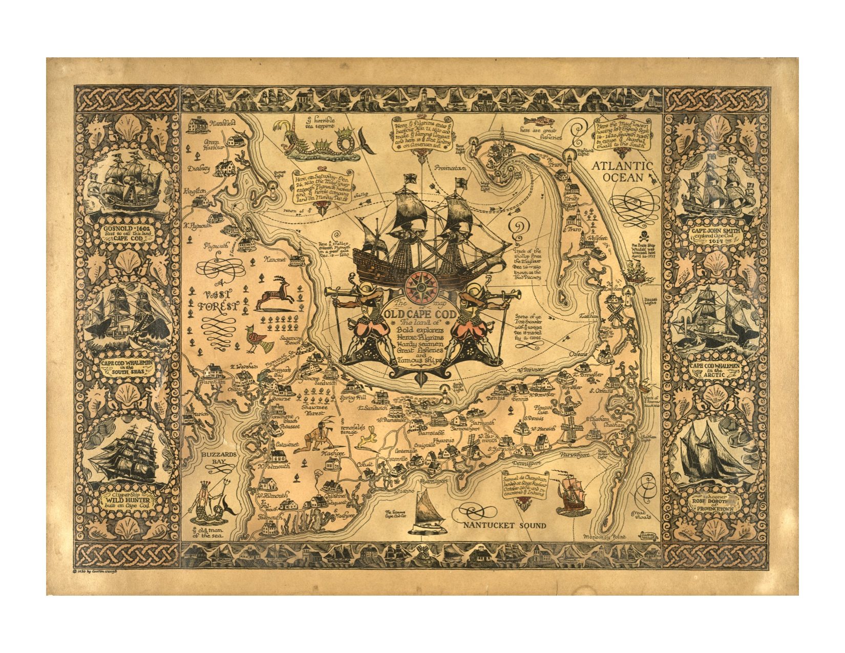
17. Old Cape Cod Decorative Map by Coulton Waugh 1930
21.5″x30″ = $100
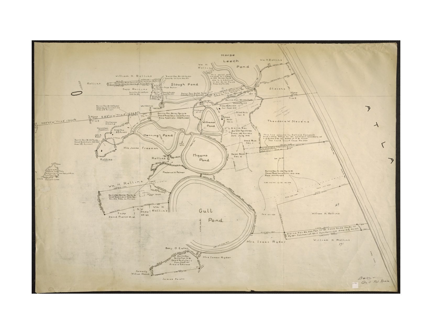
18. Truro and Wellfleet Ponds 1960
16.25″x24″ = $50
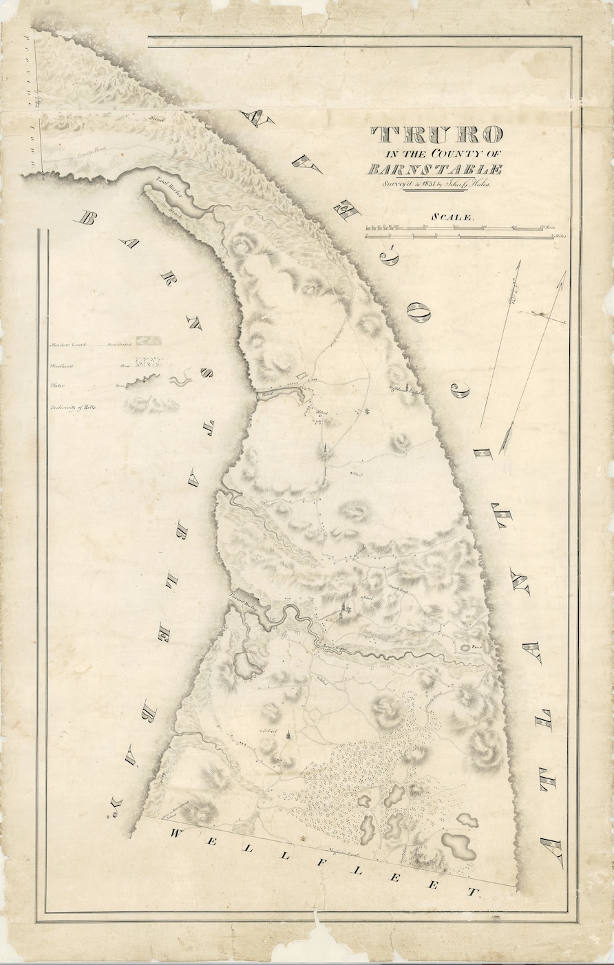
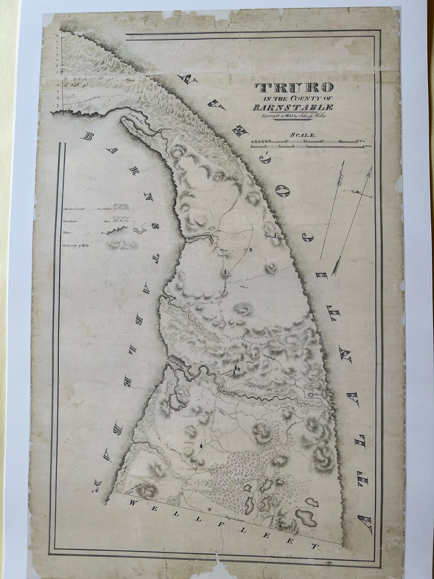
19. Hale Map of Truro 1832 — Art Copies with Archival Ink and Paper
23.5″x15″ = $80
33.75″x21.25″= $150
 20. Map of Cape Cod Leonard 1926
20″x24″= 100