Truro Historical Society offers interesting and colorful reproduction vintage maps of Truro and Cape Cod.
For more information on other maps, inquire about delivery options or shipping costs, 10% membership discount , or questions on our collection, please contact the Cobb Archive at 508.349.0200 or the Highland House museum in season (June 1 – Sept 30) at 508.487.3397
(click on image to enlarge)
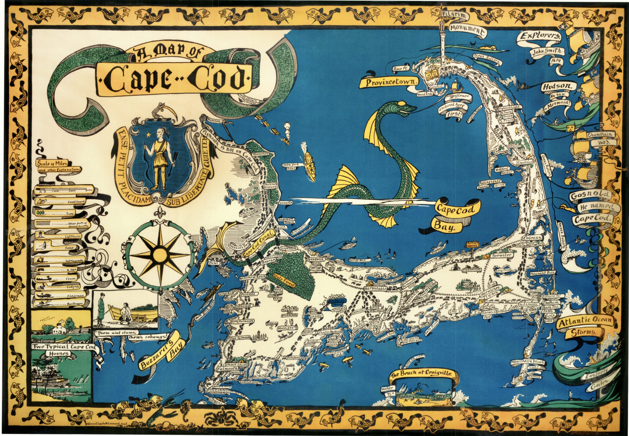
Cape Cod, 1926, by Melanie Elizabeth Leonard 18″ x 26″ $90.00
This colored reproduction of a whimsical tourist map from 1926 shows a section of interesting sites and colorful tales, including bootleggers’ boats in the bay. Along the right side are explorers and the bay features a large green sea serpent.
(click on image to enlarge)
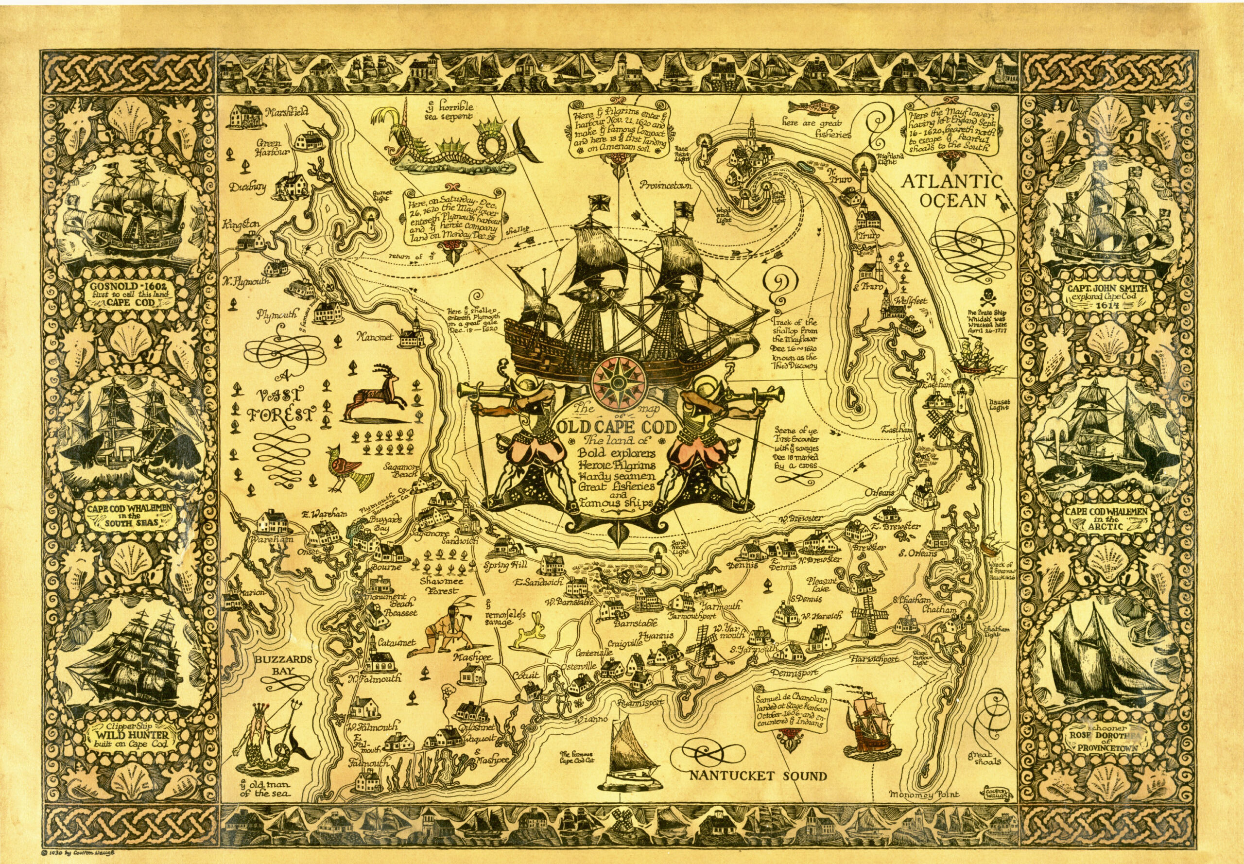
Map of Old Cape Cod, 1930 by Coulton Waugh 21.5 x 30 – $100.00
A reproduction vintage tourist map of Old Cape Cod. The centerpiece of the map in the cartouche displays “Bold Explorers, Heroic Pilgrims, Hardy Seamen, Great Fisheries, and Famous Ships”. Beautifully illustrated with many interesting Cape Cod historical events.
(click on image to enlarge)
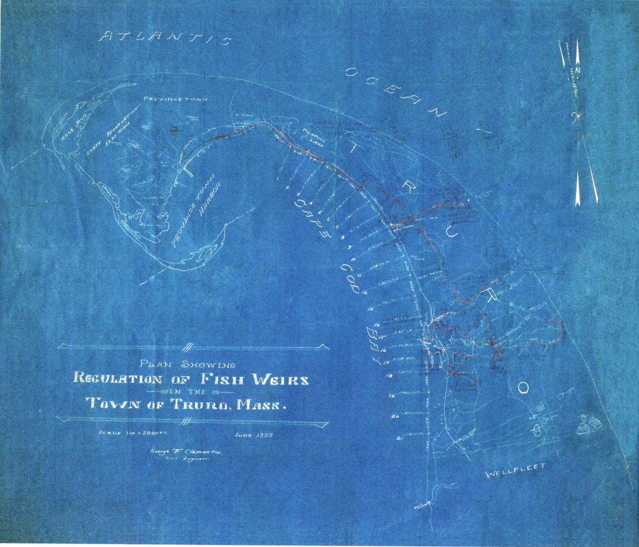
Regulated Fishing Weirs, 1923, various sizes – $40.00 – $125.00
Trap fishing is part of the Cape’s rich marine history. Hundreds of fishing weirs, or traps, were set up in the bay, regulated by the US Department of Fisheries. This reproduction map identifies the location of all the fishing weirs in Truro’s bay in 1923. Available in two sizes.
(click on image to enlarge)
Tashmuit – Map of North Truro – 25.5″ x 25.5″ – $65.00
From the mid-1650’s, an area of land in ‘Pamet’ (Truro) known as ‘Tashmuit’ was settled by the English. The area was a source of fertile land and fresh springs used by the Paomet people. This 1982 map, composed from 17th century records and later geographical surveys, details North Truro from the bay to the ocean, and also identifies colonial lot owners. Also included on the map is the purported location of the ORIGINAL Pilgrim Springs as documented in Truro Cape Cod or Land Marks and Sea Marks by Shebnah Rich, published in 1883.
(click on image to enlarge)
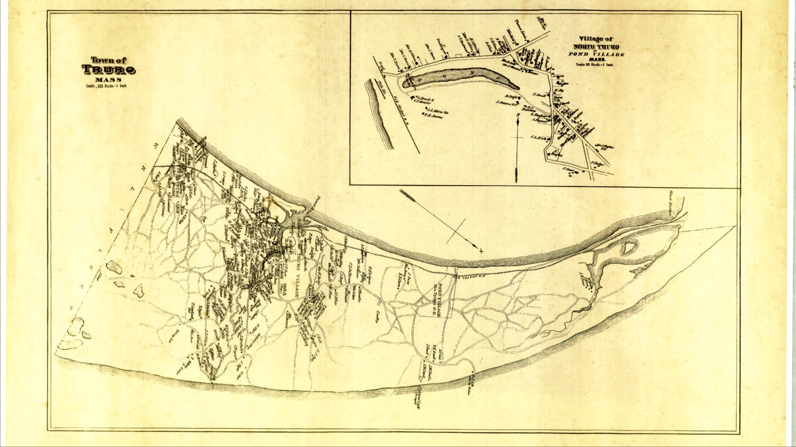
1880 Barnstable County of Truro, including Pond Village – $30.00 – $60.00
Quality reproduction map of Truro from Barnstable County records, showing a detail insert for the Pond Village, North Truro and including family names of all residents. The prints are available in four sizes: click on the link for available options.
(click on image to enlarge)
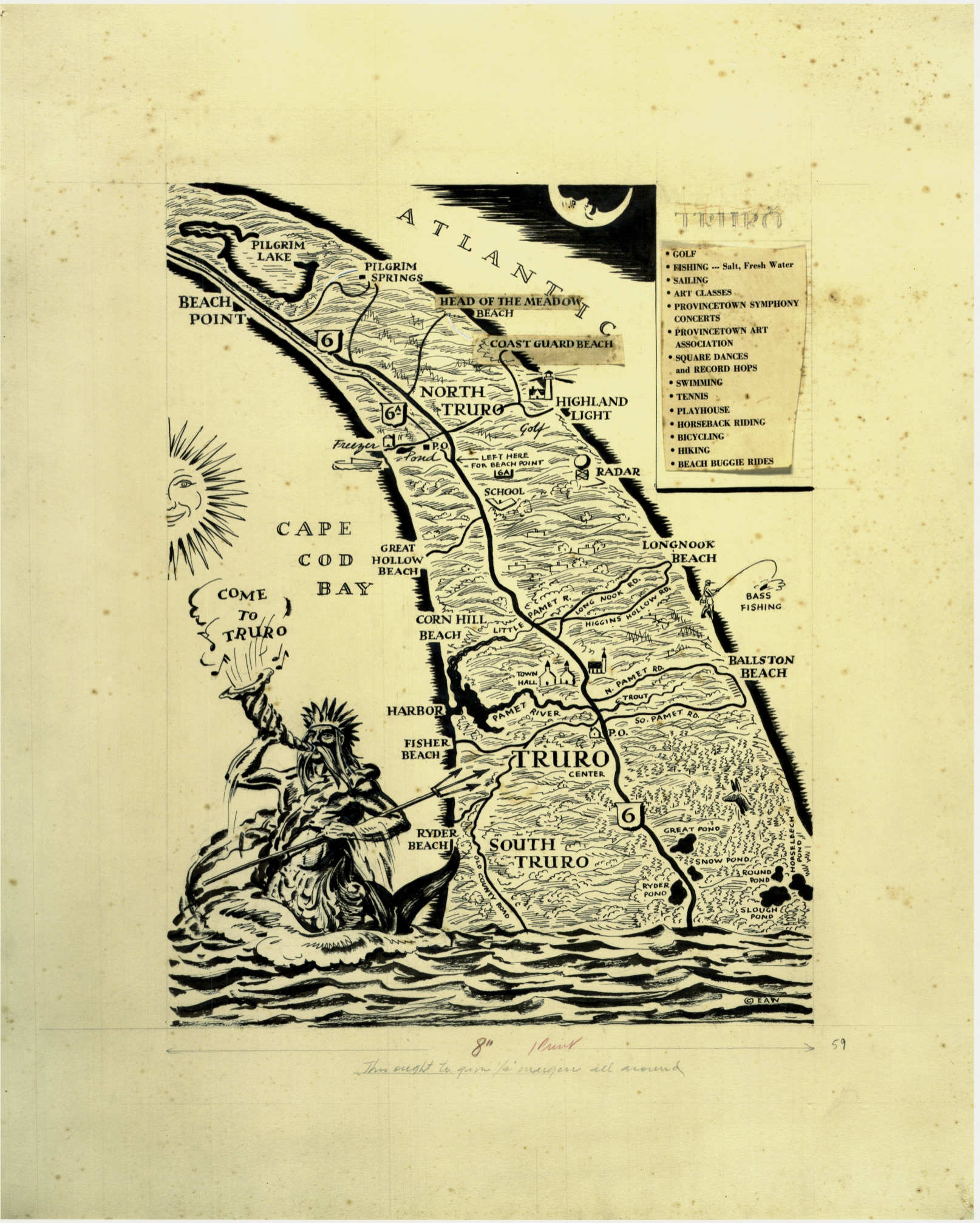
“Neptune” Map, 1960, Edward Wilson – $60.00
Edward Wilson, noted illustrator, was a Truro resident and one of the founders of the Truro Historical Society. With exclusive permission from his estate, we offer a reproduction of Wilson’s illustrated map of Truro, identifying all the town and National Seashore beaches and including an image in the lower left-hand corner of Neptune calling “Come to Truro” on a conch shell.
(click on image to enlarge)
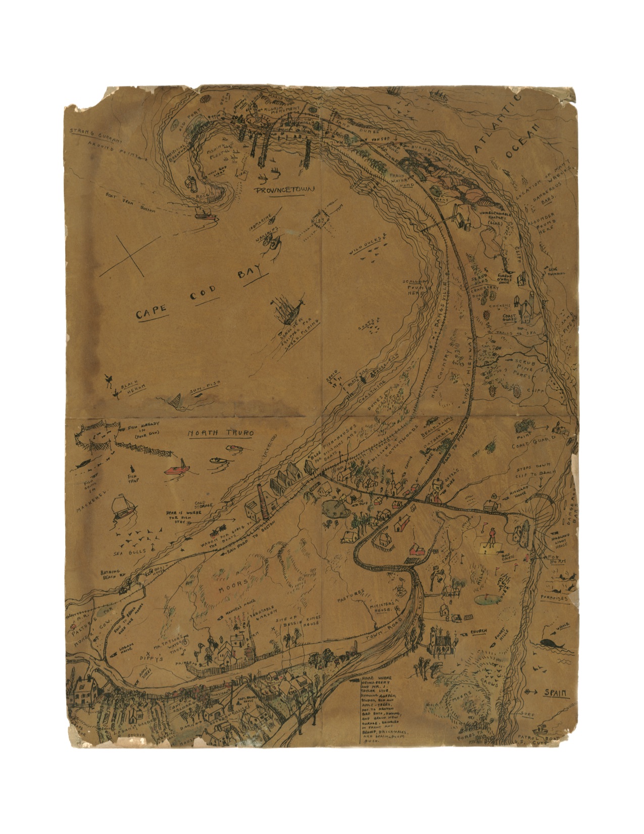
Truro, 1920’s, Jerry Farnsworth, 16″ x 20″ – $80.00
This exclusive reproduction of a color drawing made by Jerry Farnsworth, a renowned American portrait painter.
Farnsworth, along with is wife, painter Helen Sawyer, summered in Truro, where he owned and operated an art school in Pond Village. This personalized map highlights many locations Farnsworth found interesting, including places where fish can be found, where Eugene O’Neill used to swim, gardens, and cranberry bogs.
(click on image to enlarge)
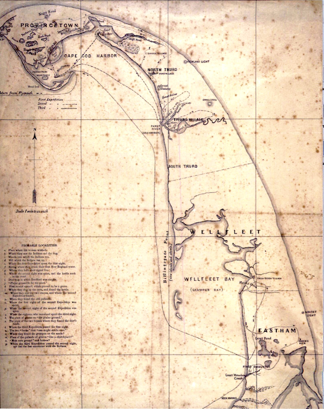
Mourt’s Relation, 1865 – $60.00
The reproduction map depicts the various expeditions and activities of the Pilgrims when landing in Provincetown Harbor in 1620, based on Mourt’s Relation, a journal written in approximately 1622. A legend in the lower-left corner identifies the travels and encounters. The authorship was first attributed to settler George Morton, though scholars now believe the work to be written by Edward Winslow with contributions from William Bradford.
(click on image to enlarge)
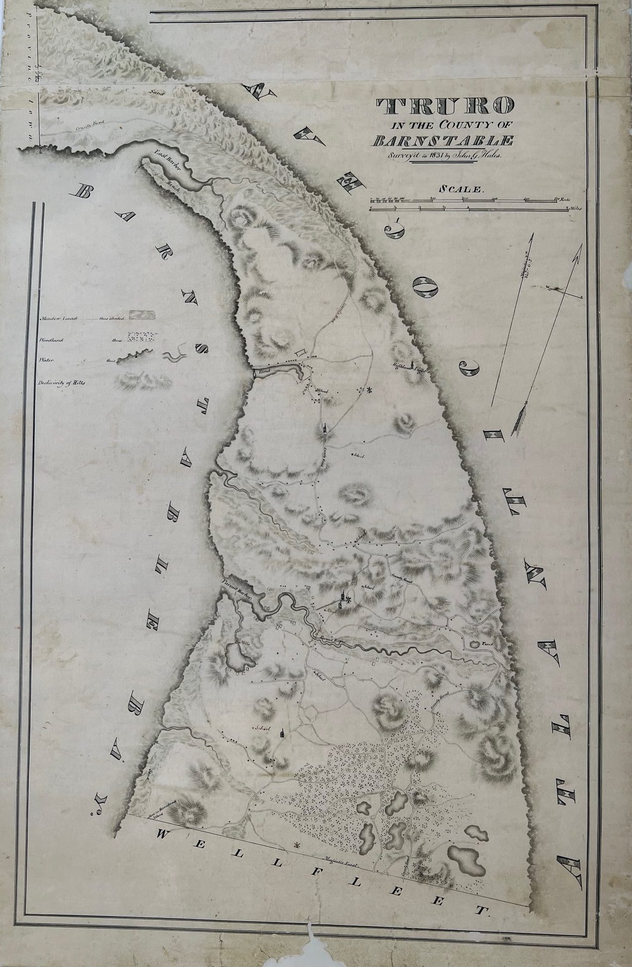
Map of Truro, 1831, John G. Hales – Various Sizes – $80.00 – $150.00
This exclusive reproduction map of Truro includes hand-drawn windmills and schools as existed in 1831. This map was purportedly used by Henry David Thoreau on his famous walks on Cape Cod.
(click on image to enlarge)
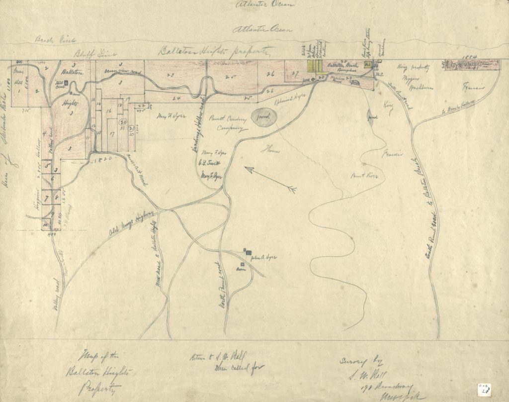
Ballston Beach Resort Survey Map, circa 1905, 11″ x 14″ – $40.00
This reproduction of a hand-drawn survey of the “Ballston Heights” property, (currently Ballston Beach area), was purportedly created by John R. Dyer on behalf of the Ball family. The map shows the location of roads leading to the Ballston property, along with lot locations for buildings that once stood on the dunes. The Pamet Cranberry Company, a small commercial cranberry operation that operated until 1962, is also highlighted on the map.

(click on image to enlarge)
Provincetown Harbor Chart, 1910, 17″ x 20″ – $60.00
This reproduction chart of Provincetown Harbor in 1910 of the Coast and Geodetic Survey conducted in 1910 of the U.S.C. & G.S highlights a complete depth chart of the harbor, lifesaving stations, ponds, and lighthouses from Provincetown to Truro. The Old Colony Railroad tracks are clearly visible along the bay.
(click on image to enlarge)
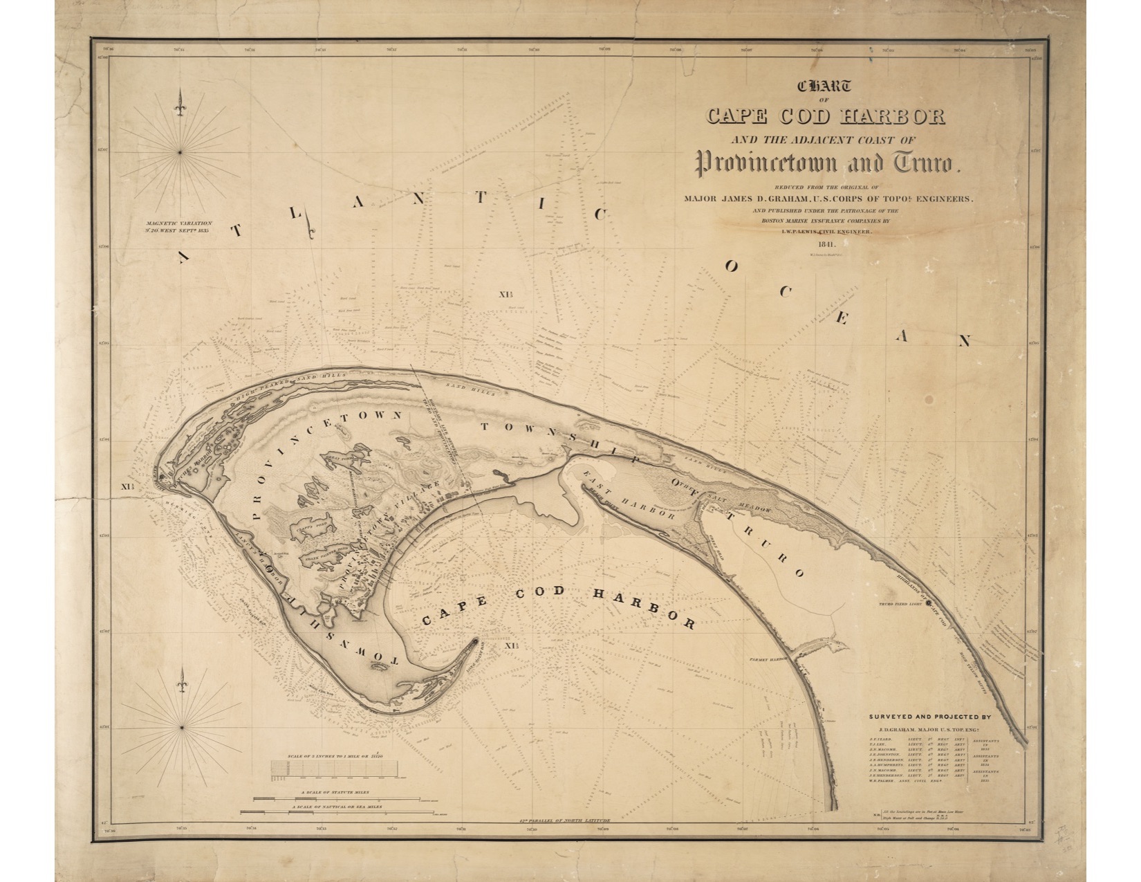
Chart of Cape Cod Harbor, 1841, Various Sizes – $70.00 – $100.00
This reproduction of a chart created in 1841 by Major James D. Graham of the U.S. Corps of Topographical Engineers, provides a detailed view of the ponds, dunes, and harbors in Provincetown and Truro.
Also included on the chart is Truro’s East Harbor, where in 1868 the inlet was filled in to make way for the railroad. This area is currently known as Pilgrim Lake, visible when traveling on Route 6 from Truro to Provincetown
(click on image to enlarge)
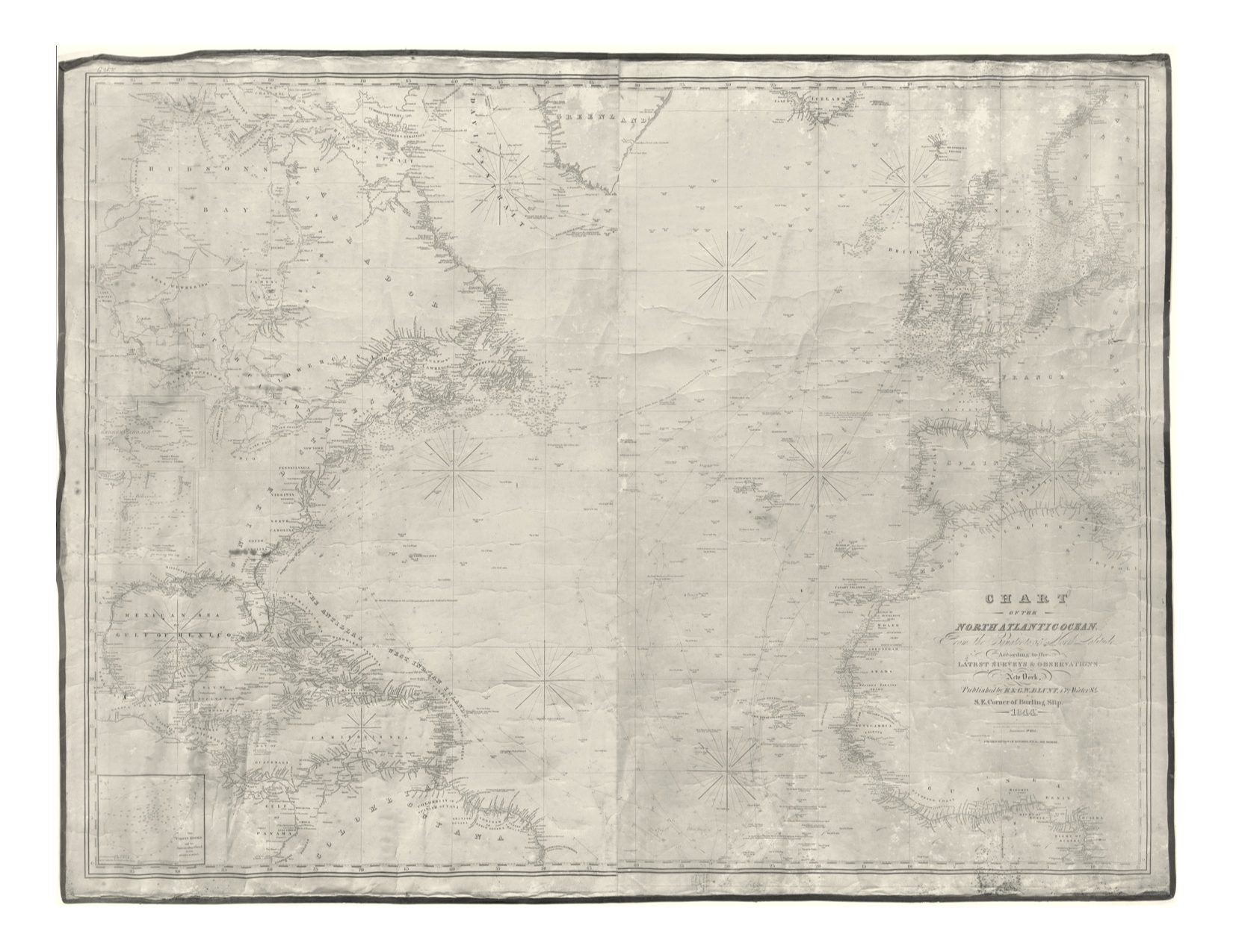
Blueback Chart of the North Atlantic, 1844 – $25.00
This reproduction chart depicts a survey of the North Atlantic, identifying shipping channels and topographical information from Greenland and Iceland to Columbia and Guinea.