
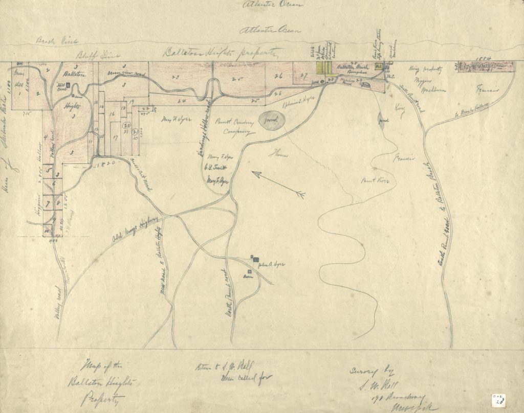
Ballston Beach Resort Survey Map, circa 1905
by John R. Dyer, 11″ x 14″
$40.00
This reproduction of a hand-drawn survey of the “Ballston Heights” property, (currently Ballston Beach area), was purportedly created by John R. Dyer on behalf of the Ball family. The map shows the location of roads leading to the Ballston property, along with lot locations for buildings that once stood on the dunes. The Pamet Cranberry Company, a small commercial cranberry operation that operated until 1962, is also highlighted on the map.